Friday, May 29, 2015


Haiti’s Most Dangerous Natural Hazards  - Mass Extinction

Considering 
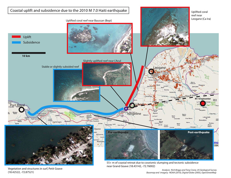
rates of occurrence, severity, damage sustained, earthquakes - nearly one quarter of one million people were lost to the human population in the 2010Quake - would have to win the top position for Haiti’s most dangerous hazard.   But, the all-time winner and my personal favorite for cross-species mass extinction are volcanoes. Although Haiti lies in the islands known as the Greater Antilles, very close by on the same Caribbean plate, lies “The Lesser Antilles Volcanic Arc which forms the eastern boundary of the Caribbean plate. It is part of a subduction zone, also known as the Lesser Antilles subduction zone, where the oceanic crust of the South American Plate is being sub-ducted under the Caribbean Plate. The Lesser Antilles Volcanic Arc includes seventeen active volcanoes -  Soufriere Hills on Montserrat; Mount Pelée on Martinique; La Grande Soufrière on Guadeloupe; Saint Vincent on Saint Vincent; and the submarine volcano Kick 'em Jenny which lies about 10 km north of Grenada.” Remember Mount Pele? It destroyed a town of thirty-thousand within minutes of eruption in 1902. Mount Pele

Why do these natural hazards happen?

Earthquakes are usually caused when tectonic plates shift in a sudden release of energy called seismic waves which shake the Earth. Continental plates at convergence are rocks pushing against each other, lacking space to move, the rocks eventually break under pressure, this breaking point is the focus and the same point above ground the epicenter. Earthquakes How are plate tectonics and volcanoes closely interrelated? Visit USGS on the connection between plate tectonic theory and plate and inter-plate volcanoes. 
Terrestrial Causes of Mass Extinction Moving continents - when all land masses on Earth combine, the global diversity will be lower (long route) Globally low sea-level – cool climate, global volcanism (short route) 
Recommendations to address the natural hazards - mitigation.  Perhaps the best mitigation is an Early Warning System for both Earthquakes and Volcanoes, but especially volcanoes are difficult to predict.  People live in and visit the Caribbean for the natural beauty which abounds there.  People are connected in their hearts to the land or for urbanites, the cities in which they live, and are quite loyal to the places in which they live. It might be difficult to convince people to move away from these gorgeous islands of the Lesser and Greater Antilles, because of a future geological hazard, such as a volcanoe due for eruption, or perhaps even because they have survived an incident as great as the quake.  The most risky areas are the fault zones and it would be safe not build even your steel frame construction within five miles either way of the Enriquillo-Plantain Garden Fault (EPGFZ), nor near the Septentrional-Orient Fault Zone (SOFZ), away from the hazards of the coastline,  mass wasting, nor any of the thousands of square miles of deforested land, as during the Hurricane season, this will all flood, and your house will wash away.  The best place to be would be in the National Forests, but not on a subterranean cave opening - on relatively high ground on solid rock formation. Bring your own cooking fuel, and be brave!


Saturday, May 16, 2015

Wildfires


A possible benefit to having the level of deforestation Haiti does, is the lack of wildfires, except in the two federally protected parks, La Visite and Pic Macaya National Forests.  Wildfires exist in the areas dry season, December through May, the opposite six months of the year from the Hurricane Season, June- November.  Government officials have been informed of a fire evolving from February 2015 until now in La Visite which began with small brush fires and continued into raging flames on several acres destroying trees.  Firefighters in Haiti have no means to fight fires. Reforested areas have recently been cut down, and the persistent 2014 drought may have exacerbated fires lit for agricultural clearing, as farmers seem to being moving into the protected areas. In the Dominican Republic, May 5, 2015, wildfires have been reported in the green Virgin Forest Los Haitises National Park in the Northeast as well as the Gaspar-Hernandez where approximately five hundred firefighters remain fighting a blaze.  The Environment Ministry of the Dominican Republic asks landowners, agricultural businesses and the populace to implement fire prevention and containment, but have also prosecuting those setting the forest fires with arson!       Dominican Today  -    Visible Earth     -  Alterpresse

Climate Change


Haiti lies in the Hurricane Corridor, a virtual Caribbean Nursery for nascent tropical storms.  “Although the effects of climate change on hurricanes and cyclones are uncertain, models generally find an increased severity of tropical storms in a warmer climate.” These, more severe tropical storms could contribute to hazards in an already environmentally degraded country leading to increased floods, erosion and destruction of infrastructure, including food sources, both inland and oceanic.  Haiti is possibly the most vulnerable country in the world to global climate change, with a high sea level rise, high population densities, fragile ecosystems, flooding, droughts, hurricanes, earthquakes, and landslides as human contributions to environmental degradation.  

Saturday, May 2, 2015

Coastal Hazards - Haiti


Haiti is frequently exposed to hydrometerological and other climate-related hazards caused by atmospheric disturbances.  These are: tsunamis, tropical waves and hurricanes, and polar fronts which expose coastal populations to strong winds, storm surges, and wave coastal flooding.  These combined hazards, in addition to coastal erosion, make for a hazardous shoreline.

Tsunamis

The subduction zone in which the Greater Antilles is located is well known for producing tsunamigenic earth-quakes as it did with a 2-3 meter tsunami on Port-Au Prince’s shoreline which killed three post-earthquake on January 12, 2010, bringing Haiti’s total Tsunami count to ten.

Storm Surges  

Haiti’s geographical proximity to Jamaica to the southwest and Cuba to the west reduces the exposure of Portau-Prince bay to storm surges generated by tropical cyclones that usually travel from east to west. The coasts in this bay nonetheless remain exposed to rising sea levels caused by locally generated winds.  The southern part of the island has bathymetric features heightening storm surges. Exposed to strong hurricane winds, the island’s Caribbean southern coastline could sustain particularly significant damage from long and strong surges (tidal waves) of 8-10 meters.    


Saturday, April 25, 2015

Hurricanes in Haiti


Tropical Storm Isaac
In Haiti, Hurricanes have a long and damaging history.  In 1816 a cyclone caused considerable damage in the countryside and the Gulf of Gonaives.  On the 12th of November 1909 a cyclone hits with one-hundred fifty victims. On August 12, 1915, another cyclone on the southern peninsula devastates Jacmel and Jeremie. On the 21st of October, 1935 a hurricane in the South and Southeast Departments killed over two-thousand and Hurricane Hazel killed several thousand people October 11-12, 1954. Hurricane Flora killed over eight thousand people in 1963. Hurricane Cleo hits the south coast and causes one-hundred and ninety-two deaths.  In 1966, on the 29th of September, Hurricane Inez the South and West Departments.  Hurricane Gordon killed over one-thousand Haitians in 1994, and in 1998, Hurricane Georges killed over four hundred while destroying eight percent of all the crops in the country.  In 1980, Haiti still had twenty-five percent of its forests, allowing the nation to withstand Hurricane Emily, in 1987 without a single loss of life, but Hurricane Allen on the fifth of August caused approximately two hundred deaths. On the eleventh of September 1988, Hurricane Gilbert devastates the south coast.  Tropical Storms Jeanne and Gordon long with almost complete deforestation contributed to devastating floods which killed thousands. November 12 and 13, 1994 Hurricane Gordon enters the scene.  On the 23rd of September 1998, Hurricane Georges causes one hundred forty seven deaths. 10 JUY 2005 16:15 UTC Hurricane Dennis.  And on the 17-18 of October Hurricane Wilma strikes the west and south coast of Haiti, on the 23rd of October, Tropical Storm Alpha (they had run out of names Hurricane Jeanne of 2004 passed just north of the country as a tropical storm, dumping thirteen inches of rains on the nation's northern mountains. The resulting floods killed over three thousand people, mostly in the town of Gonaives, reporting two thousand eight hundred deaths. In May of 2004, three days of heavy rains from a tropical disturbance dumped more than 18 inches of rain in the mountains, triggering floods which killed over two thousand six hundred people.  The hurricane season of 2008 was a devastating and memorable natural disaster.  Four storms: Fay (16 AUG), Gustav (26 AUG), Hanna (1 SEP), and Ike (6 SEP) - rained heavily on a land ninety-eight percent deforested. Haiti suffered seven hundred and ninety-three people killed, with three hundred and ten missing and another five hundred and ninety-three injured. The flood destroyed seventy percent of agricultural crops, resulting in dozens of deaths of children due to malnutrition in the months following the storms. On the fifth of November 2010, Hurricane Thomas kills ten Haitians. Hurricane Isaac resulted in the loss of twenty-four individuals in August 2012. Hurricane Sandy, October 22, 2012 kills fifty-seven people in Haiti.relief.org

The question is why do so many hurricanes start in the Caribbean and the deadliest of those start off of the western coast of Africa?  Hurricane season is from June 1, to November 1.  The water must be 80 degree Fahrenheit down to one-hundred and fifty feet. But first, other conditions have to be right, such as a disturbance in the atmosphere, developing into an area of low atmospheric pressure.  Winds move to the center of the storm creating a funnel from surrounding areas if higher air pressure.  Warm water heats the air, making it rise, condensing as thunderstorms. This tropical depression becomes a storm under the right conditions into a swirling mass. Rising air in the center produces more heat and increasing the speed.  The air comes out of the top of the funnel like a chimney. Strong winds atop this funnel can slow a storm.  In the Northern Hemisphere, low pressure systems rotate counterclockwise and it is called the Coriolis Effect.   As storms cup up from the south, northern waters, or over land make the storm lose its strength (which it gains from the warm water), but gains speed and gust. livescience.org     

Saturday, April 18, 2015

Subsidence


SubsidenceCave


SubsidenceBridge - Steve Z Photography
Subsidence - ground failure of the Earth's surface as it shifts downward in vertical deformations commonly known as sinkholes,  soil subsidence can mean erosion as well, or anywhere soil subsides - especially on flat surfaces.  The result of water through limestone results in these beautiful blue cave flowstone formations in La Visite National Park, Haiti!

"After the January 12, 2010 Earthquake coastal subsidence and uplift was noted in Haiti.

noaa.gov

 
On January 16, 2010 the Federal Emergency Management Agency requested NOAA's assistance in acquiring high-resolution aerial imagery as seen above:

Coastal Subsidence can also cause flooding


Saturday, April 11, 2015

Cange, Haiti


Rob Sheridan’s picture shows an example of a scarp created by a slump on a hillside near the Artibonite River Valley

Mass wasting is mechanical erosion bought on by the slopes lack of resistance to gravity.

Causes of mass wasting:                                                                                                          
  - earthquakes

  • overburden from structures
  • increased soil moisture
  • reduction of roots holding the soil to bedrock
  • undercutting of slope
  • weathering
  • bioturbation
  • volcanic edifice over-steepening


Mitigation: Read here about tree-planting, more tree-planting  & terracing

Mass Wasting - Learn More Here

After Hurricane Jeanne, The United Nations Security Council created the United Nations Stabilization Mission in Haiti to assist in restoring political order and economic recovery. The Environmental Group has outlined three priority interventions involving environmental management: 1) reduction of pressure on wood resources, 2) improved environmental resource management and planning, and 3) sustainable and integrated disaster risk management through the implementation of a National Risk and Disaster Management Plan. The national civil protection agency is in charge of risk and disaster management activities. It is headed by the National Committee of Risk and Disaster Management, led by the Ministry of Interior. The Permanent Secretariat of Risk and Disaster Management, led by the General Directorate of the Ministry of Interior. http://www.champ.gatech/